 vesseltracker.com
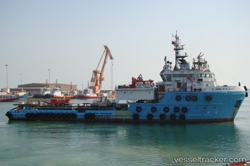
Vessel '403611000' IMO: 9487512, MMSI: 403611000
UTC, 26.66886, 50.18355, course: 1, speed: 0
UTC, 26.66882, 50.18353, course: 2, speed: 0
2026-01-13 09:53:31 UTC, 26.66895, 50.18352, course: 1, speed: 0
Live AIS position:
UTC. Near Ras Tannurah),
updated 2026-01-13 09:53:31 UTC.
Find the position of the vessel '403611000' on the map. The latter are known coordinates and path.
marine traffic ship tracker show on live map
The current position of vessel '403611000' is 26.66895 lat / 50.18352 lng. Updated: 2026-01-13 09:53:31 UTCDetails:
Last coordinates of the vessel:
UTC, 26.66890, 50.18357, course: 1, speed: 0UTC, 26.66886, 50.18355, course: 1, speed: 0
UTC, 26.66882, 50.18353, course: 2, speed: 0
2026-01-13 09:53:31 UTC, 26.66895, 50.18352, course: 1, speed: 0