vessel ROSE GAS IMO: 9247209, LPG Tanker vesseltracker.com
Vessel ROSE GAS IMO: 9247209, LPG Tanker
MMSI: 419001664 callsign: VTLS size: x

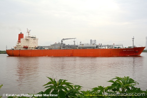
Find the position of the vessel ROSE GAS on the map. The latter are known coordinates and path.

marine traffic ship tracker show on live map

The current position of vessel ROSE GAS is 12.9229 lat / 74.8107 lng. Updated: 2025-07-29 19:40:00 UTC

Currently sailing under the flag of India

ROSE GAS built in 2003 year

Deadweight:
26534 t

Details:


Last coordinates of the vessel:
UTC, 12.9229, 74.8107, course: 325, speed: 0
UTC, 12.9229, 74.8107, course: 324, speed: 0
2025-07-29 19:40:00 UTC, 12.9229, 74.8107, course: 324, speed: 0


Most frequent ports a vessels calls at ROSE GAS (419001664):

Kandla, traffic: 4
Az Zarqa Island, traffic: 3
Mina Abd Allah, traffic: 1
Mina Al Ahmadi, traffic: 1
Mina Az Zawr, traffic: 1
Cochin, traffic: 1

Link to the map:


Find another ship

ROSE_GAS (419001664) last ports (portcalls and passsages)

Kandla | 2024-01-04 14:11:57
Az Zarqa Island | 2023-12-29 19:45:41
Kandla | 2023-12-25 15:49:28
Cochin | 2023-12-20 14:24:38
Kandla | 2023-12-08 13:29:05
Mina Az Zawr | 2022-10-09 02:00:11
Mina Abd Allah | 2022-10-06 19:38:42
Kandla | 2022-05-06 08:00:43
Az Zarqa Island | 2022-01-23 01:24:34