vessel Tour 2 IMO: 9364112, Crude Oil Tanker
vesseltracker.com
Vessel Tour 2 IMO: 9364112, Crude Oil Tanker
MMSI: 422038400 callsign: EPBY7 size: 48x274

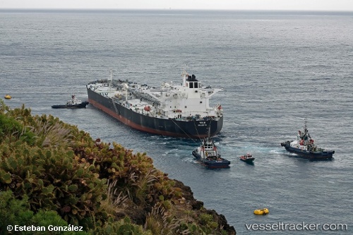
Find the position of the vessel Tour 2 on the map. The latter are known coordinates and path.

marine traffic ship tracker show on live map

The current position of vessel Tour 2 is 26.982 lat / 56.3775 lng. Updated: 2025-04-30 12:23:12 UTC
Payload_mass:
158817 tonne
Gross tonnage:
81295
Service entry:
2007-01-01T00:00:00Z
Details:


Last coordinates of the vessel:
UTC, 26.9805, 56.3738, course: 110, speed: 0
UTC, 26.9821, 56.3757, course: 163, speed: 0
UTC, 26.9823, 56.3767, course: 195, speed: 0
2025-04-30 12:23:12 UTC, 26.982, 56.3775, course: 217, speed: 0


Most frequent ports a vessels calls at Tour 2 (422038400):

QUESHM, traffic: 2
Bandar Abbas, traffic: 2
LARAK, traffic: 2
TANAH MERAH, traffic: 1
JASK, traffic: 1
Kharg Island, traffic: 1
JURONG ISLAND, traffic: 1
RAJAEI, traffic: 1
BATU AMPAR, traffic: 1

Link to the map:


Find another ship

Tour_2 (422038400) last ports (portcalls and passsages)

RAJAEI | 2025-04-28 14:35:29
QUESHM | 2025-04-21 23:10:49
LARAK | 2025-04-12 21:58:29
LARAK | 2025-04-04 00:37:58
QUESHM | 2025-04-03 15:27:09
JASK | 2025-04-02 23:25:49
JURONG ISLAND | 2025-03-23 17:17:17
TANAH MERAH | 2025-03-23 15:46:23
Kharg Island | 2022-02-25 09:05:24
Bandar Abbas | 2021-12-01 00:39:23