 vesseltracker.com
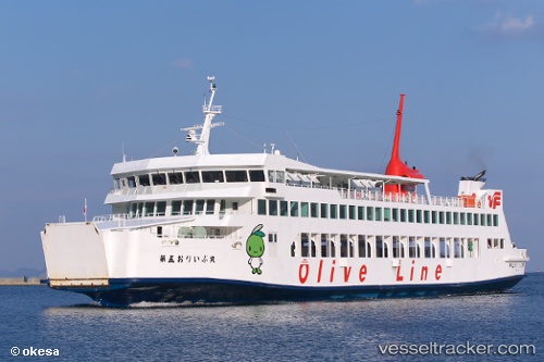
Vessel Olive Maru No.5 IMO: 9759094, MMSI: 431005301 Passenger Ro Ro Cargo Ship
UTC, 34.69175, 134.51538, course: 250, speed: 15
UTC, 34.61107, 134.42903, course: 221, speed: 15
2026-01-17 11:14:33 UTC, 34.54290, 134.34508, course: 60, speed: 0.2
Live AIS position:
UTC. Near TONOSHO),
updated 2026-01-17 11:14:33 UTC.
Find the position of the vessel Olive Maru No.5 on the map. The latter are known coordinates and path.
marine traffic ship tracker show on live map
The current position of vessel Olive Maru No.5 is 34.54290 lat / 134.34508 lng. Updated: 2026-01-17 11:14:33 UTCCurrently sailing under the flag of Japan
Details:
Last coordinates of the vessel:
UTC, 34.71577, 134.58727, course: 246, speed: 15UTC, 34.69175, 134.51538, course: 250, speed: 15
UTC, 34.61107, 134.42903, course: 221, speed: 15
2026-01-17 11:14:33 UTC, 34.54290, 134.34508, course: 60, speed: 0.2