 vesseltracker.com
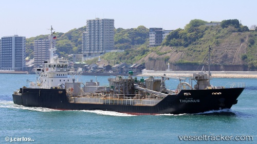
Vessel Thunnus IMO: 8974776, MMSI: 431602111 Pusher Tug
UTC, 33.90875, 131.17535, course: 107, speed: 0
UTC, 33.93720, 131.23631, course: 257, speed: 0
2026-01-18 00:09:30 UTC, 33.93720, 131.23628, course: 257, speed: 0
Live AIS position:
UTC. Near Ube),
updated 2026-01-18 00:09:30 UTC.
Find the position of the vessel Thunnus on the map. The latter are known coordinates and path.
marine traffic ship tracker show on live map
The current position of vessel Thunnus is 33.93720 lat / 131.23628 lng. Updated: 2026-01-18 00:09:30 UTCDetails:
Last coordinates of the vessel:
UTC, 33.90878, 131.17537, course: 108, speed: 0UTC, 33.90875, 131.17535, course: 107, speed: 0
UTC, 33.93720, 131.23631, course: 257, speed: 0
2026-01-18 00:09:30 UTC, 33.93720, 131.23628, course: 257, speed: 0