 vesseltracker.com
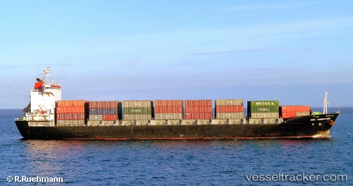
Vessel Kharis Heritage IMO: 9402512, MMSI: 440190000 Container Ship
UTC, 15.69414, 109.61752, course: 218, speed: 16.3
UTC, 15.47954, 109.43466, course: 215, speed: 16
2026-01-18 17:20:24 UTC, 15.24407, 109.33591, course: 189, speed: 15.8
Live AIS position:
UTC. 29 nm E of Dung Quat Petroleum Port),
updated 2026-01-18 17:20:24 UTC.
Find the position of the vessel Kharis Heritage on the map. The latter are known coordinates and path.
marine traffic ship tracker show on live map
The current position of vessel Kharis Heritage is 15.24407 lat / 109.33591 lng. Updated: 2026-01-18 17:20:24 UTCCurrently sailing under the flag of Korea
Details:
Last coordinates of the vessel:
UTC, 15.69414, 109.61752, course: 218, speed: 16.3UTC, 15.69414, 109.61752, course: 218, speed: 16.3
UTC, 15.47954, 109.43466, course: 215, speed: 16
2026-01-18 17:20:24 UTC, 15.24407, 109.33591, course: 189, speed: 15.8