 vesseltracker.com
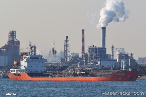
Vessel Gloriwind IMO: 9449649, MMSI: 477969100 Oil Products Tanker
UTC, 49.09333, 146.53667, course: -1, speed: 7
UTC, 49.09333, 146.53667, course: -1, speed: 7
2026-01-18 18:19:47 UTC, 49.14416, 146.55028, course: 10, speed: 7.9
Live AIS position:
UTC. 89 nm SE of Tehovec),
updated 2026-01-18 18:19:47 UTC.
Find the position of the vessel Gloriwind on the map. The latter are known coordinates and path.
marine traffic ship tracker show on live map
The current position of vessel Gloriwind is 49.14416 lat / 146.55028 lng. Updated: 2026-01-18 18:19:47 UTCDetails:
Last coordinates of the vessel:
UTC, 49.08833, 146.53500, course: -1, speed: 7UTC, 49.09333, 146.53667, course: -1, speed: 7
UTC, 49.09333, 146.53667, course: -1, speed: 7
2026-01-18 18:19:47 UTC, 49.14416, 146.55028, course: 10, speed: 7.9