 vesseltracker.com
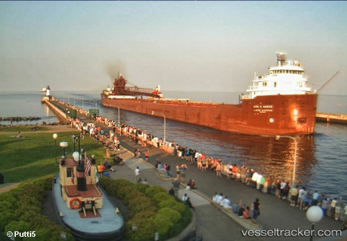
Find the position of the vessel Kaye E Barker on the map. The latter are known coordinates and path.
marine traffic ship tracker show on live map
The current position of vessel Kaye E Barker is 46.5789 lat / -87.3877 lng. Updated: 2025-07-07 15:34:44 UTCCurrently sailing under the flag of USA
Kaye E Barker built in 1952 year
Deadweight:
25345 tDetails:
Last coordinates of the vessel:
UTC, 46.5801, -87.3893, course: 319, speed: 0UTC, 46.5802, -87.3891, course: 319, speed: 0
UTC, 46.5801, -87.3892, course: 319, speed: 0
2025-07-07 15:34:44 UTC, 46.5789, -87.3877, course: 320, speed: 0