 vesseltracker.com
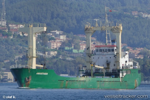
Find the position of the vessel ANASTASIA on the map. The latter are known coordinates and path.
marine traffic ship tracker show on live map
The current position of vessel ANASTASIA is 32.84439 lat / 34.99878 lng. Updated: 2025-11-15 18:19:08 UTCCurrently sailing under the flag of Palau (Republic of)
ANASTASIA built in 1996 year
Deadweight:
4056 tDetails:
Last coordinates of the vessel:
UTC, 32.84442, 34.99880, course: 302, speed: 0.4UTC, 32.84440, 34.99874, course: 327, speed: 0.2
UTC, 32.84430, 34.99869, course: 317, speed: 0.5
2025-11-15 18:19:08 UTC, 32.84439, 34.99878, course: 310, speed: 0.3
The ship also appears on the maps: