 vesseltracker.com
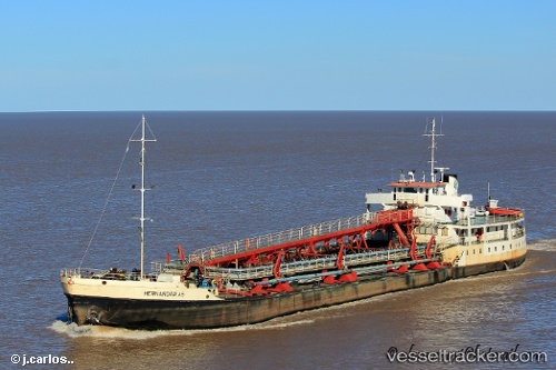
Vessel Hernandarias IMO: 5149394, MMSI: 701006545 Oil Products Tanker
UTC, -34.64532, -58.34047, course: 163, speed: 6.2
UTC, -34.65768, -58.33963, course: -1, speed: 0
2026-01-19 21:23:50 UTC, -34.65766, -58.33966, course: -1, speed: 0
Live AIS position:
UTC. Near Dock Sur),
updated 2026-01-19 21:23:50 UTC.
Find the position of the vessel Hernandarias on the map. The latter are known coordinates and path.
marine traffic ship tracker show on live map
The current position of vessel Hernandarias is -34.65766 lat / -58.33966 lng. Updated: 2026-01-19 21:23:50 UTCCurrently sailing under the flag of Argentina
Details:
Last coordinates of the vessel:
UTC, -34.48437, -58.38446, course: 136, speed: 8.9UTC, -34.64532, -58.34047, course: 163, speed: 6.2
UTC, -34.65768, -58.33963, course: -1, speed: 0
2026-01-19 21:23:50 UTC, -34.65766, -58.33966, course: -1, speed: 0