.
vessel Seri Cemara IMO: 9756389, Lng Tanker
vesseltracker.com
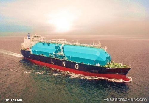
Vessel Seri Cemara IMO: 9756389, MMSI: 533130753 Lng Tanker

callsign: 9MYD8
size: 290x49

Live AIS position: UTC. 28 nm W of Samalaju), updated 2026-01-13 09:27:24 UTC.

Find the position of the vessel Seri Cemara on the map. The latter are known coordinates and path.

marine traffic ship tracker show on live map

The current position of vessel Seri Cemara is 3.70865 lat / 112.86882 lng. Updated: 2026-01-13 09:27:24 UTC

Currently sailing under the flag of Malaysia

Details:


Last coordinates of the vessel:
UTC, 3.24893, 112.87543, course: 348, speed: 0
UTC, 3.24893, 112.87552, course: 349, speed: 0
UTC, 3.43506, 112.88305, course: 8, speed: 13.6
2026-01-13 09:27:24 UTC, 3.70865, 112.86882, course: 342, speed: 13.9


Most frequent ports a vessels calls at Seri Cemara (533130753):

Kota Kinabalu, traffic: 11
Sambu, traffic: 5
Singapore, traffic: 5
TANAH MERAH, traffic: 4
SEMBAWANG, traffic: 4
Yokosuka, traffic: 4
PASIR GUDANG, traffic: 4
Kawasaki, traffic: 4
Johor, traffic: 4
BATU AMPAR, traffic: 3
PENGERANG, traffic: 3
Yokohama, traffic: 3
PULAU SAMBU, traffic: 3
Map Ta Phut, traffic: 3
TEKONG ISLAND, traffic: 2

Link to the map:


Find another ship

Seri_Cemara (533130753) last ports (portcalls and passsages)

TANAH MERAH | 2025-08-02 06:31:31
SUNGAI UDANG | 2025-07-30 07:48:01
PULAU SAMBU | 2025-07-29 22:11:42
PENGERANG | 2025-07-29 20:42:13
BINTULU | 2025-07-15 08:38:56
Singapore | 2025-07-10 06:28:55
PULAU SAMBU | 2025-07-10 06:16:12
JURONG ISLAND | 2025-07-08 16:34:20
BUKOM ISLAND | 2025-07-08 15:07:52
BATU AMPAR | 2025-07-08 13:41:38
PENGERANG | 2025-07-08 02:13:08
CHANGI | 2025-07-08 01:07:29
PASIR GUDANG | 2025-07-06 03:09:52
PASIR GUDANG | 2025-07-02 01:47:05
PASIR GUDANG | 2025-06-23 02:16:21
SEMBAWANG | 2025-06-18 01:42:42
PASIR GUDANG | 2025-06-18 01:13:54
CHANGI | 2025-06-18 00:12:44
PENGERANG | 2025-06-16 22:25:29
DAECHEONHANG | 2025-06-07 03:46:02
DAECHEONHANG | 2025-04-26 23:06:14
JURONG ISLAND | 2025-03-29 00:33:52
PULAU SAMBU | 2025-03-28 22:31:28
BATU AMPAR | 2025-03-28 21:39:43
TANAH MERAH | 2025-03-28 21:12:45
Map Ta Phut | 2025-03-04 01:53:53
Yokohama | 2025-02-07 02:59:09
Kawasaki | 2025-02-07 01:59:28
Yokosuka | 2025-02-07 01:12:44
Kawasaki | 2025-01-05 00:53:13
KIMITSU | 2025-01-04 00:59:08
Yokosuka | 2025-01-03 23:44:16
Yokkaichi | 2024-12-05 01:22:53
Singapore | 2024-10-02 04:02:30
Kota Kinabalu | 2024-05-02 13:48:14
Kota Kinabalu | 2024-04-28 13:35:54
Kota Kinabalu | 2024-04-08 12:28:30
Kota Kinabalu | 2024-04-01 10:23:53
Kota Kinabalu | 2024-03-14 10:05:27
Map Ta Phut | 2024-03-08 11:24:23
Map Ta Phut | 2024-01-15 01:11:26
Yosu | 2023-11-17 23:59:24
Yokosuka | 2023-11-04 04:59:24
Yokohama | 2023-11-03 02:59:38
Torres Strait | 2023-10-03 03:36:02
Gladstone Harbor | 2023-09-27 14:06:17
Yokkaichi | 2023-09-14 01:05:40
Pei-Hai | 2023-07-31 17:06:16
Kota Kinabalu | 2023-06-08 04:43:21
Yokohama | 2023-05-23 01:14:26
Yokosuka | 2023-05-22 23:24:27
Singapore | 2023-05-08 03:18:55
Kota Kinabalu | 2022-09-22 07:20:12
Kota Kinabalu | 2022-04-12 18:44:07
Higashi-Iwase | 2022-04-05 06:36:27
Kota Kinabalu | 2022-02-06 03:00:33
Kota Kinabalu | 2021-09-30 16:05:43