 vesseltracker.com
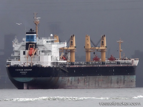
Vessel Union Explorer IMO: 9449259, MMSI: 538007145 Chemical Oil Products Tanker
UTC, 13.10037, 80.35813, course: 230, speed: 6.8
UTC, 13.07380, 80.33463, course: 70, speed: 0.4
2026-01-13 14:38:06 UTC, 13.07360, 80.33453, course: 57, speed: 0.2
Live AIS position:
UTC. Near Madras),
updated 2026-01-13 14:38:06 UTC.
Find the position of the vessel Union Explorer on the map. The latter are known coordinates and path.
marine traffic ship tracker show on live map
The current position of vessel Union Explorer is 13.07360 lat / 80.33453 lng. Updated: 2026-01-13 14:38:06 UTCDetails:
Last coordinates of the vessel:
UTC, 13.19002, 80.46355, course: 226, speed: 12.5UTC, 13.10037, 80.35813, course: 230, speed: 6.8
UTC, 13.07380, 80.33463, course: 70, speed: 0.4
2026-01-13 14:38:06 UTC, 13.07360, 80.33453, course: 57, speed: 0.2