 vesseltracker.com
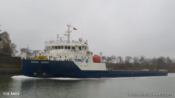
Vessel TOPAZ BELAYA IMO: 9811579, MMSI: 538007325 Heavy Load Carrier
UTC, 24.29833, 54.44333, course: -1, speed: 0
UTC, 24.29867, 54.44463, course: 36, speed: 0
2026-01-13 18:30:45 UTC, 24.29833, 54.44333, course: -1, speed: 0
Live AIS position:
UTC. Near Esnnad),
updated 2026-01-13 18:30:45 UTC.
Find the position of the vessel TOPAZ BELAYA on the map. The latter are known coordinates and path.
marine traffic ship tracker show on live map
The current position of vessel TOPAZ BELAYA is 24.29833 lat / 54.44333 lng. Updated: 2026-01-13 18:30:45 UTCCurrently sailing under the flag of Marshall Islands
TOPAZ BELAYA built in 2017 year
Deadweight:
2969 tDetails:
Last coordinates of the vessel:
UTC, 24.29869, 54.44463, course: 36, speed: 0UTC, 24.29833, 54.44333, course: -1, speed: 0
UTC, 24.29867, 54.44463, course: 36, speed: 0
2026-01-13 18:30:45 UTC, 24.29833, 54.44333, course: -1, speed: 0