 vesseltracker.com
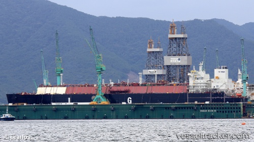
Live AIS position:
27.58333° N, 88.75500° W UTC. 88 nm S of Port Eads),
updated 2025-11-22 15:19:58 UTC.
Find the position of the vessel Flex Rainbow on the map. The latter are known coordinates and path.
marine traffic ship tracker show on live map
The current position of vessel Flex Rainbow is 27.58333 lat / -88.75500 lng. Updated: 2025-11-22 15:19:58 UTCDetails:
Last coordinates of the vessel:
UTC, 28.37282, -89.14642, course: 155, speed: 18.1UTC, 28.03221, -88.97404, course: 152, speed: 18.7
UTC, 27.65333, -88.78667, course: -1, speed: 18
2025-11-22 15:19:58 UTC, 27.58333, -88.75500, course: -1, speed: 18