 vesseltracker.com
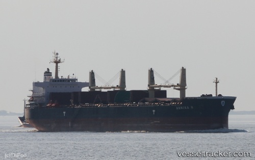
Vessel ANNIKA N IMO: 9514054, MMSI: 538008791
UTC, 30.04767, -90.83858, course: 345, speed: 0
UTC, 30.04777, -90.83865, course: 345, speed: 0
2026-01-13 15:33:20 UTC, 30.04773, -90.83853, course: 345, speed: 0
Live AIS position:
UTC. Near Romeville),
updated 2026-01-13 15:33:20 UTC.
Find the position of the vessel ANNIKA N on the map. The latter are known coordinates and path.
marine traffic ship tracker show on live map
The current position of vessel ANNIKA N is 30.04773 lat / -90.83853 lng. Updated: 2026-01-13 15:33:20 UTCDetails:
Last coordinates of the vessel:
UTC, 30.04768, -90.83862, course: 345, speed: 0UTC, 30.04767, -90.83858, course: 345, speed: 0
UTC, 30.04777, -90.83865, course: 345, speed: 0
2026-01-13 15:33:20 UTC, 30.04773, -90.83853, course: 345, speed: 0