 vesseltracker.com
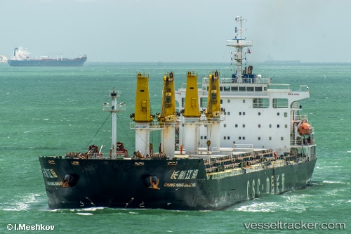
Vessel AL SAAD IMO: 9436111, MMSI: 538010022 Bulk Carrier
UTC, 11.66801, 43.19163, course: 81, speed: 0
UTC, 11.66817, 43.19166, course: 86, speed: 0
2026-01-17 12:46:05 UTC, 11.66826, 43.19163, course: 90, speed: 0
Live AIS position:
UTC. Near Djibouti),
updated 2026-01-17 12:46:05 UTC.
Find the position of the vessel AL SAAD on the map. The latter are known coordinates and path.
marine traffic ship tracker show on live map
The current position of vessel AL SAAD is 11.66826 lat / 43.19163 lng. Updated: 2026-01-17 12:46:05 UTCCurrently sailing under the flag of Marshall Islands
AL SAAD built in 2010 year
Deadweight:
57124 tDetails:
Last coordinates of the vessel:
UTC, 11.66811, 43.19158, course: 86, speed: 0UTC, 11.66801, 43.19163, course: 81, speed: 0
UTC, 11.66817, 43.19166, course: 86, speed: 0
2026-01-17 12:46:05 UTC, 11.66826, 43.19163, course: 90, speed: 0