 vesseltracker.com
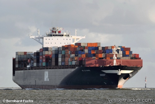
Vessel Apl Le Havre IMO: 9461881, MMSI: 566407000 Container Ship
UTC, 32.08084, -81.05947, course: 92, speed: 5.6
UTC, 31.95460, -80.68594, course: 107, speed: 8.9
2026-01-13 15:32:04 UTC, 31.91991, -80.40917, course: 85, speed: 8.5
Live AIS position:
UTC. 22 nm E of Tybee Island),
updated 2026-01-13 15:32:04 UTC.
Find the position of the vessel Apl Le Havre on the map. The latter are known coordinates and path.
marine traffic ship tracker show on live map
The current position of vessel Apl Le Havre is 31.91991 lat / -80.40917 lng. Updated: 2026-01-13 15:32:04 UTCCurrently sailing under the flag of Singapore
Apl Le Havre built in 2012 year
Deadweight:
123137 tDetails:
Last coordinates of the vessel:
UTC, 32.13418, -81.14241, course: 354, speed: 0.1UTC, 32.08084, -81.05947, course: 92, speed: 5.6
UTC, 31.95460, -80.68594, course: 107, speed: 8.9
2026-01-13 15:32:04 UTC, 31.91991, -80.40917, course: 85, speed: 8.5