 vesseltracker.com
Live AIS position:
7.44858° S, 115.19419° E UTC. 36 nm S of Arjasa),
updated 2025-11-19 17:54:36 UTC.
Find the position of the vessel Ince Ilgaz on the map. The latter are known coordinates and path.
marine traffic ship tracker show on live map
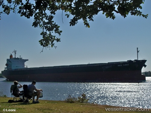
The current position of vessel Ince Ilgaz is -7.44858 lat / 115.19419 lng. Updated: 2025-11-19 17:54:36 UTCCurrently sailing under the flag of Singapore
Ince Ilgaz built in 2010 year
Deadweight:
76579 tDetails:
Last coordinates of the vessel:
UTC, -6.97169, 114.77477, course: 129, speed: 13UTC, -6.97169, 114.77477, course: 129, speed: 13
UTC, -7.29281, 115.06415, course: 138, speed: 13.5
2025-11-19 17:54:36 UTC, -7.44858, 115.19419, course: 140, speed: 13.2