vessel SEGULL IMO: 9260366, LPG Tanker vesseltracker.com
Vessel SEGULL IMO: 9260366, LPG Tanker
MMSI: 574004790 callsign: XVHK7 size: x

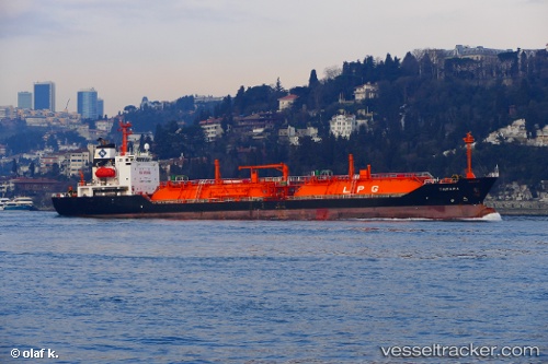
Find the position of the vessel SEGULL on the map. The latter are known coordinates and path.

marine traffic ship tracker show on live map

The current position of vessel SEGULL is 38.013153333333 lat / 23.539571666667 lng. Updated: 2025-10-10 10:37:48 UTC

Currently sailing under the flag of Vietnam

SEGULL built in 2002 year

Deadweight:
6017 t

Details:


Last coordinates of the vessel:
UTC, 38.014526666667, 23.538566666667, course: 116, speed: 0.1
UTC, 38.015, 23.538333333333, course: -1, speed: 0
UTC, 38.014963333333, 23.539421666667, course: 176, speed: 0
2025-10-10 10:37:48 UTC, 38.013153333333, 23.539571666667, course: 0, speed: 0.1


Most frequent ports a vessels calls at SEGULL (574004790):

Ra’S Shukhayr, traffic: 3
Bur Ibrahim, traffic: 3
Istanbul, traffic: 2
Uskudar, traffic: 2
Canakkale, traffic: 2
Gelibolu, traffic: 2
Kakinada, traffic: 1
Port Said, traffic: 1
Ras Gharib, traffic: 1
Ambarli, traffic: 1
Marmara Island , traffic: 1

Link to the map:


Find another ship

SEGULL (574004790) last ports (portcalls and passsages)

Ra’S Shukhayr | 2024-01-10 00:53:07
Ras Gharib | 2024-01-09 23:02:25
Bur Ibrahim | 2024-01-09 14:14:42
Port Said | 2024-01-09 04:14:35
Canakkale | 2024-01-05 22:44:41
Gelibolu | 2024-01-05 21:00:15
Ambarli | 2024-01-04 13:33:40
Uskudar | 2024-01-04 12:04:10
Uskudar | 2023-12-20 22:19:34
Marmara Island | 2023-12-19 19:07:58
Gelibolu | 2023-12-19 14:44:13
Canakkale | 2023-12-19 12:14:52
Bur Ibrahim | 2023-12-16 07:48:26
Ra’S Shukhayr | 2023-12-13 06:00:44
Ra’S Shukhayr | 2023-12-09 05:19:09
Bur Ibrahim | 2023-12-08 19:05:29
Kakinada | 2022-03-25 17:19:36