 vesseltracker.com
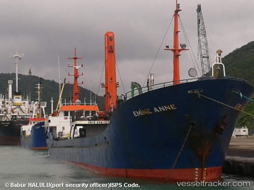
Vessel Emine Anne IMO: 9145360, MMSI: 577397000 General Cargo Ship
UTC, 40.46384, 26.77090, course: 56, speed: 0.1
UTC, 40.46357, 26.77109, course: 45, speed: 0.3
2026-01-17 03:35:35 UTC, 40.46359, 26.77114, course: 36, speed: 0.4
Live AIS position:
UTC. Near Gelibolu),
updated 2026-01-17 03:35:35 UTC.
Find the position of the vessel Emine Anne on the map. The latter are known coordinates and path.
marine traffic ship tracker show on live map
The current position of vessel Emine Anne is 40.46359 lat / 26.77114 lng. Updated: 2026-01-17 03:35:35 UTCCurrently sailing under the flag of Vanuatu
Emine Anne built in 1996 year
Deadweight:
1602 tDetails:
Last coordinates of the vessel:
UTC, 40.46382, 26.77086, course: 51, speed: 0.7UTC, 40.46384, 26.77090, course: 56, speed: 0.1
UTC, 40.46357, 26.77109, course: 45, speed: 0.3
2026-01-17 03:35:35 UTC, 40.46359, 26.77114, course: 36, speed: 0.4