vessel Aquamarie IMO: 9591739, Bulk Carrier
vesseltracker.com
Vessel Aquamarie IMO: 9591739, Bulk Carrier
MMSI: 636018338 callsign: D5PG9 size: 292x45

Find the position of the vessel Aquamarie on the map. The latter are known coordinates and path.

marine traffic ship tracker show on live map

The current position of vessel Aquamarie is 51.7498 lat / 2.37066 lng. Updated: 2025-03-23 17:40:31 UTC

Currently sailing under the flag of Liberia
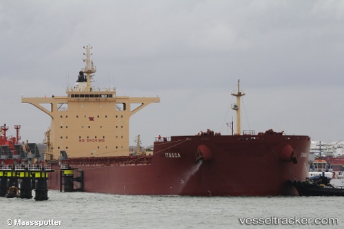
Payload_mass:
178896 tonne
Gross tonnage:
92865
Service entry:
2012-01-01T00:00:00Z

Manufacturer:
Sungdong Shipbuilding & Marine Engineering (South Korean shipbuilding company)
Details:


Last coordinates of the vessel:
2025-03-23 17:40:31 UTC, 51.7498, 2.37066, course: 220, speed: 15.3


Most frequent ports a vessels calls at Aquamarie (636018338):

Taku Bar, traffic: 7
Dagu Bar, traffic: 6
Selat Lombok, traffic: 4
Port Walcot, traffic: 2
Samson Point, traffic: 2
Yeosu, traffic: 2
Busan, traffic: 2
Yosu, traffic: 2
Morro Redondo, traffic: 2
HOEK VAN HOLLAND, traffic: 1
Sambu, traffic: 1
BRIELLE, traffic: 1
Wu-Sung, traffic: 1
Wusong, traffic: 1
Algeciras, traffic: 1

Link to the map:


Find another ship

Aquamarie (636018338) last ports (portcalls and passsages)

BRIELLE | 2025-03-18 01:16:15
Yeosu | 2023-03-18 20:59:42
Yosu | 2023-03-14 17:53:48
Taicang | 2023-03-10 20:50:18
Wu-Sung | 2023-03-10 18:04:24
Sambu | 2023-02-22 23:10:46
Algeciras | 2022-12-31 12:04:57
Morro Redondo | 2022-07-23 19:14:05
Morro Redondo | 2022-07-19 19:12:23
Busan | 2022-06-30 07:23:05
Busan | 2022-06-25 11:06:50
Taku Bar | 2022-01-16 21:39:19
Dagu Bar | 2022-01-16 21:26:08
Dagu Bar | 2022-01-14 03:23:36
Dagu Bar | 2022-01-14 03:06:35
Taku Bar | 2022-01-14 02:35:55
Selat Lombok | 2021-12-25 03:40:31
Port Walcot | 2021-12-16 10:56:21
Selat Lombok | 2021-12-13 16:11:20