 vesseltracker.com
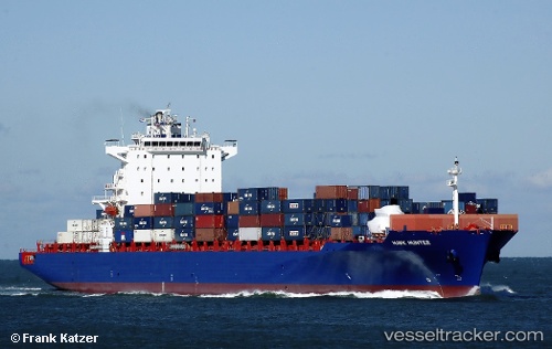
Vessel 636093031 IMO: 9439498, MMSI: 636093031
UTC, 37.55039, -76.03893, course: 2, speed: 20
UTC, 38.47860, -76.39028, course: 336, speed: 20.3
2026-01-17 09:35:00 UTC, 38.53062, -76.42084, course: 336, speed: 20.4
Live AIS position:
UTC. Near Prince Frederick),
updated 2026-01-17 09:35:00 UTC.
Find the position of the vessel 636093031 on the map. The latter are known coordinates and path.
marine traffic ship tracker show on live map
The current position of vessel 636093031 is 38.53062 lat / -76.42084 lng. Updated: 2026-01-17 09:35:00 UTCDetails:
Last coordinates of the vessel:
UTC, 37.03739, -76.06605, course: 323, speed: 17.8UTC, 37.55039, -76.03893, course: 2, speed: 20
UTC, 38.47860, -76.39028, course: 336, speed: 20.3
2026-01-17 09:35:00 UTC, 38.53062, -76.42084, course: 336, speed: 20.4