 vesseltracker.com
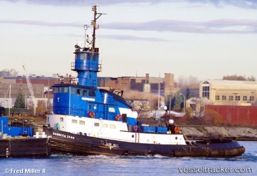
Vessel Rebeccalynn IMO: 6511374, MMSI: 366936810 Tug
UTC, 41.72728, -87.54174, course: 204, speed: 1.9
UTC, 41.71667, -87.54280, course: 171, speed: 2
2026-01-16 11:29:40 UTC, 41.69687, -87.55555, course: 91, speed: 0
Live AIS position:
UTC. Near CALUMET HARBOR),
updated 2026-01-16 11:29:40 UTC.
Find the position of the vessel Rebeccalynn on the map. The latter are known coordinates and path.
marine traffic ship tracker show on live map
The current position of vessel Rebeccalynn is 41.69687 lat / -87.55555 lng. Updated: 2026-01-16 11:29:40 UTCDetails:
Last coordinates of the vessel:
UTC, 41.73460, -87.52195, course: 204, speed: 0.5UTC, 41.72728, -87.54174, course: 204, speed: 1.9
UTC, 41.71667, -87.54280, course: 171, speed: 2
2026-01-16 11:29:40 UTC, 41.69687, -87.55555, course: 91, speed: 0