vessel Hong Xiang IMO: 8864921, Aggregates Carrier
vesseltracker.com
Vessel Hong Xiang IMO: 8864921, Aggregates Carrier
MMSI: 667001735 callsign: 9LU2538 size: 13x90

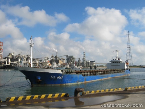
Find the position of the vessel Hong Xiang on the map. The latter are known coordinates and path.

marine traffic ship tracker show on live map

The current position of vessel Hong Xiang is 36.68704 lat / 36.19377 lng. Updated: 2025-09-29 02:20:15 UTC
Details:


Last coordinates of the vessel:
UTC, 36.68704, 36.19377, course: 245, speed: 0
2025-09-29 02:20:15 UTC, 36.68704, 36.19377, course: 245, speed: 0


Most frequent ports a vessels calls at Hong Xiang (667001735):

Taku Bar, traffic: 14
Dagu Bar, traffic: 14
Incheon, traffic: 3
Dagu, traffic: 2
Ta-Ku, traffic: 2
Kao-Hsiung Kang, traffic: 1

Link to the map:


Find another ship

Hong_Xiang (667001735) last ports (portcalls and passsages)

Incheon | 2021-12-30 02:10:20
Taku Bar | 2021-12-27 01:42:29
Taku Bar | 2021-12-27 01:40:09
Dagu Bar | 2021-12-25 02:53:15
Dagu Bar | 2021-12-25 01:51:34
Dagu | 2021-12-22 19:58:23
Dagu Bar | 2021-12-22 10:09:12
Dagu Bar | 2021-12-22 10:04:21
Dagu Bar | 2021-12-22 09:59:21
Taku Bar | 2021-12-22 09:40:21
Taku Bar | 2021-12-22 08:49:21
Incheon | 2021-12-08 08:56:20
Kao-Hsiung Kang | 2021-09-30 16:09:01