 vesseltracker.com
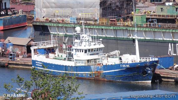
Vessel Valdimar H IMO: 6807785, MMSI: 257168000 Fish Carrier
UTC, 70.97997, 25.97114, course: -1, speed: 0
UTC, 70.97995, 25.97105, course: -1, speed: 0
2026-01-16 13:34:13 UTC, 70.97995, 25.97105, course: -1, speed: 0
Live AIS position:
UTC. Near HONNINGSVAAG),
updated 2026-01-16 13:34:13 UTC.
Find the position of the vessel Valdimar H on the map. The latter are known coordinates and path.
marine traffic ship tracker show on live map
The current position of vessel Valdimar H is 70.97995 lat / 25.97105 lng. Updated: 2026-01-16 13:34:13 UTCCurrently sailing under the flag of Norway
Valdimar H built in 1968 year
Details:
Last coordinates of the vessel:
UTC, 70.97995, 25.97113, course: -1, speed: 0UTC, 70.97997, 25.97114, course: -1, speed: 0
UTC, 70.97995, 25.97105, course: -1, speed: 0
2026-01-16 13:34:13 UTC, 70.97995, 25.97105, course: -1, speed: 0