 vesseltracker.com
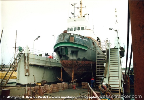
Vessel Viking IMO: 7011606, MMSI: 273350380 Tug
UTC, 60.60361, 28.54723, course: 154, speed: 0
UTC, 60.60362, 28.54724, course: 155, speed: 0
2026-01-15 08:55:19 UTC, 60.60333, 28.54667, course: -1, speed: 0
Live AIS position:
UTC. Near Vysotsk),
updated 2026-01-15 08:55:19 UTC.
Find the position of the vessel Viking on the map. The latter are known coordinates and path.
marine traffic ship tracker show on live map
The current position of vessel Viking is 60.60333 lat / 28.54667 lng. Updated: 2026-01-15 08:55:19 UTCCurrently sailing under the flag of Russia
Viking built in 1970 year
Deadweight:
150 tDetails:
Last coordinates of the vessel:
UTC, 60.60361, 28.54723, course: 154, speed: 0UTC, 60.60361, 28.54723, course: 154, speed: 0
UTC, 60.60362, 28.54724, course: 155, speed: 0
2026-01-15 08:55:19 UTC, 60.60333, 28.54667, course: -1, speed: 0