 vesseltracker.com
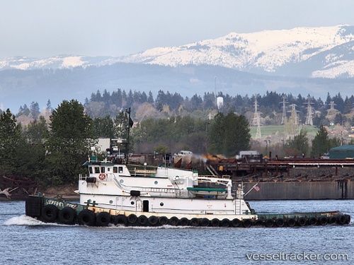
Vessel Taku Wind IMO: 7029536, MMSI: 366932120 Tug
UTC, 30.40022, -88.01741, course: 3, speed: 8.1
UTC, 30.64742, -88.03177, course: 8, speed: 6.7
2026-01-17 09:24:50 UTC, 30.47588, -88.01739, course: 176, speed: 5.8
Live AIS position:
UTC. Near Point Clear),
updated 2026-01-17 09:24:50 UTC.
Find the position of the vessel Taku Wind on the map. The latter are known coordinates and path.
marine traffic ship tracker show on live map
The current position of vessel Taku Wind is 30.47588 lat / -88.01739 lng. Updated: 2026-01-17 09:24:50 UTCDetails:
Last coordinates of the vessel:
UTC, 30.37566, -88.02056, course: 32, speed: 0.9UTC, 30.40022, -88.01741, course: 3, speed: 8.1
UTC, 30.64742, -88.03177, course: 8, speed: 6.7
2026-01-17 09:24:50 UTC, 30.47588, -88.01739, course: 176, speed: 5.8