 vesseltracker.com
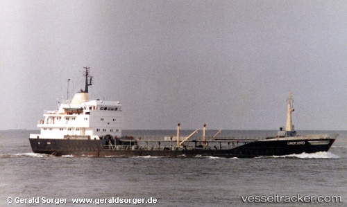
Vessel SOPHIA IMO: 7113375, MMSI: 620980000 Oil Products Tanker
UTC, 26.29141, 56.04549, course: 216, speed: 5.7
UTC, 26.19328, 55.96108, course: 227, speed: 5.3
2026-01-17 16:24:21 UTC, 26.14317, 55.90286, course: 220, speed: 7
Live AIS position:
UTC. Near Hulaylah Terminal),
updated 2026-01-17 16:24:21 UTC.
Find the position of the vessel SOPHIA on the map. The latter are known coordinates and path.
marine traffic ship tracker show on live map
The current position of vessel SOPHIA is 26.14317 lat / 55.90286 lng. Updated: 2026-01-17 16:24:21 UTCCurrently sailing under the flag of Comoros
SOPHIA built in 1971 year
Deadweight:
3184 tDetails:
Last coordinates of the vessel:
UTC, 26.30513, 56.06495, course: 216, speed: 5.8UTC, 26.29141, 56.04549, course: 216, speed: 5.7
UTC, 26.19328, 55.96108, course: 227, speed: 5.3
2026-01-17 16:24:21 UTC, 26.14317, 55.90286, course: 220, speed: 7