 vesseltracker.com
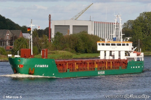
Vessel Coimbra IMO: 7228091, MMSI: 263555000 Fishing Vessel
UTC, -46.17075, -60.79518, course: -1, speed: 2
UTC, -46.28534, -60.82968, course: -1, speed: 5
2026-01-16 05:56:07 UTC, -46.45139, -60.86656, course: -1, speed: 1.4
Live AIS position:
UTC. 221 nm E of Puerto Deseado),
updated 2026-01-16 05:56:07 UTC.
Find the position of the vessel Coimbra on the map. The latter are known coordinates and path.
marine traffic ship tracker show on live map
The current position of vessel Coimbra is -46.45139 lat / -60.86656 lng. Updated: 2026-01-16 05:56:07 UTCCurrently sailing under the flag of Portugal
Coimbra built in 1973 year
Deadweight:
1702 tDetails:
Last coordinates of the vessel:
UTC, -46.10282, -60.78411, course: -1, speed: 4.5UTC, -46.17075, -60.79518, course: -1, speed: 2
UTC, -46.28534, -60.82968, course: -1, speed: 5
2026-01-16 05:56:07 UTC, -46.45139, -60.86656, course: -1, speed: 1.4