 vesseltracker.com
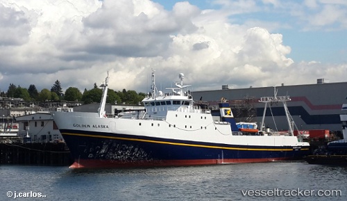
Vessel Golden Alaska IMO: 7229710, MMSI: 338132000 Fishing Vessel
UTC, 52.88477, -143.07481, course: -1, speed: 15.6
UTC, 52.96525, -143.62271, course: -1, speed: 14.9
2026-01-17 17:18:02 UTC, 52.96525, -143.62271, course: -1, speed: 14.9
Live AIS position:
UTC. 195 nm E of Kings Bromley),
updated 2026-01-17 17:18:02 UTC.
Find the position of the vessel Golden Alaska on the map. The latter are known coordinates and path.
marine traffic ship tracker show on live map
The current position of vessel Golden Alaska is 52.96525 lat / -143.62271 lng. Updated: 2026-01-17 17:18:02 UTCDetails:
Last coordinates of the vessel:
UTC, 52.88477, -143.07481, course: -1, speed: 15.6UTC, 52.88477, -143.07481, course: -1, speed: 15.6
UTC, 52.96525, -143.62271, course: -1, speed: 14.9
2026-01-17 17:18:02 UTC, 52.96525, -143.62271, course: -1, speed: 14.9