 vesseltracker.com
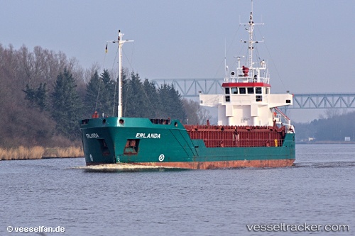
Vessel Erlanda IMO: 8922280, MMSI: 730152005 General Cargo Ship
UTC, 10.36956, -75.50912, course: 16, speed: 0
UTC, 10.36955, -75.50915, course: 17, speed: 0
2026-01-16 17:26:02 UTC, 10.36957, -75.50919, course: 17, speed: 0
Live AIS position:
UTC. Near Contecar),
updated 2026-01-16 17:26:02 UTC.
Find the position of the vessel Erlanda on the map. The latter are known coordinates and path.
marine traffic ship tracker show on live map
The current position of vessel Erlanda is 10.36957 lat / -75.50919 lng. Updated: 2026-01-16 17:26:02 UTCDetails:
Last coordinates of the vessel:
UTC, 10.36952, -75.50920, course: 15, speed: 0UTC, 10.36956, -75.50912, course: 16, speed: 0
UTC, 10.36955, -75.50915, course: 17, speed: 0
2026-01-16 17:26:02 UTC, 10.36957, -75.50919, course: 17, speed: 0