 vesseltracker.com
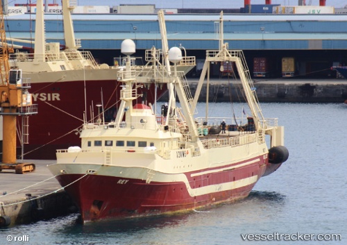
Vessel Rey IMO: 7336563, MMSI: 312448000 Fish Factory Ship
UTC, 10.35368, -14.80055, course: -1, speed: 0
UTC, 10.35368, -14.80055, course: -1, speed: 0
2026-01-17 05:48:20 UTC, 10.35382, -14.80077, course: -1, speed: 0
Live AIS position:
UTC. 11 nm SW of Port de Boké),
updated 2026-01-17 05:48:20 UTC.
Find the position of the vessel Rey on the map. The latter are known coordinates and path.
marine traffic ship tracker show on live map
The current position of vessel Rey is 10.35382 lat / -14.80077 lng. Updated: 2026-01-17 05:48:20 UTCDetails:
Last coordinates of the vessel:
UTC, 10.35318, -14.80064, course: -1, speed: 0.4UTC, 10.35368, -14.80055, course: -1, speed: 0
UTC, 10.35368, -14.80055, course: -1, speed: 0
2026-01-17 05:48:20 UTC, 10.35382, -14.80077, course: -1, speed: 0