 vesseltracker.com
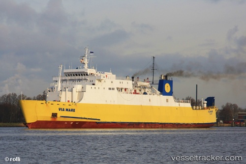
Vessel Via Mare IMO: 7411258, MMSI: 271055018 Passenger Ro Ro Cargo Ship
UTC, 36.31119, 33.89046, course: 182, speed: 0
UTC, 36.31119, 33.89046, course: 182, speed: 0
2026-01-17 22:10:57 UTC, 36.31119, 33.89046, course: 182, speed: 0
Live AIS position:
UTC. Near TASUCU),
updated 2026-01-17 22:10:57 UTC.
Find the position of the vessel Via Mare on the map. The latter are known coordinates and path.
marine traffic ship tracker show on live map
The current position of vessel Via Mare is 36.31119 lat / 33.89046 lng. Updated: 2026-01-17 22:10:57 UTCCurrently sailing under the flag of Turkey
Via Mare built in 1976 year
Deadweight:
3927 tDetails:
Last coordinates of the vessel:
UTC, 36.31119, 33.89046, course: 182, speed: 0UTC, 36.31119, 33.89046, course: 182, speed: 0
UTC, 36.31119, 33.89046, course: 182, speed: 0
2026-01-17 22:10:57 UTC, 36.31119, 33.89046, course: 182, speed: 0