 vesseltracker.com
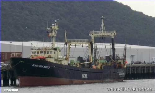
Vessel Dongwon519 IMO: 7416480, MMSI: 512228000 Fishing Vessel
UTC, -48.18810, 168.38023, course: -1, speed: 2.2
UTC, -48.14578, 168.44463, course: -1, speed: 3.4
2026-01-16 17:50:46 UTC, -48.09393, 168.51427, course: -1, speed: 3.7
Live AIS position:
UTC. 73 nm S of STEWART ISLAND),
updated 2026-01-16 17:50:46 UTC.
Find the position of the vessel Dongwon519 on the map. The latter are known coordinates and path.
marine traffic ship tracker show on live map
The current position of vessel Dongwon519 is -48.09393 lat / 168.51427 lng. Updated: 2026-01-16 17:50:46 UTCDetails:
Last coordinates of the vessel:
UTC, -48.20230, 168.35596, course: -1, speed: 5UTC, -48.18810, 168.38023, course: -1, speed: 2.2
UTC, -48.14578, 168.44463, course: -1, speed: 3.4
2026-01-16 17:50:46 UTC, -48.09393, 168.51427, course: -1, speed: 3.7