 vesseltracker.com
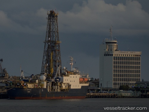
Vessel Joides Resolution IMO: 7423081, MMSI: 209489000 Drilling Ship
UTC, 58.11431, 7.04490, course: -1, speed: 0
UTC, 58.11429, 7.04497, course: -1, speed: 0
2026-01-17 18:26:27 UTC, 58.11431, 7.04497, course: -1, speed: 0
Live AIS position:
UTC. Near LYNGDAL),
updated 2026-01-17 18:26:27 UTC.
Find the position of the vessel Joides Resolution on the map. The latter are known coordinates and path.
marine traffic ship tracker show on live map
The current position of vessel Joides Resolution is 58.11431 lat / 7.04497 lng. Updated: 2026-01-17 18:26:27 UTCDetails:
Last coordinates of the vessel:
UTC, 58.11433, 7.04490, course: -1, speed: 0UTC, 58.11431, 7.04490, course: -1, speed: 0
UTC, 58.11429, 7.04497, course: -1, speed: 0
2026-01-17 18:26:27 UTC, 58.11431, 7.04497, course: -1, speed: 0