 vesseltracker.com
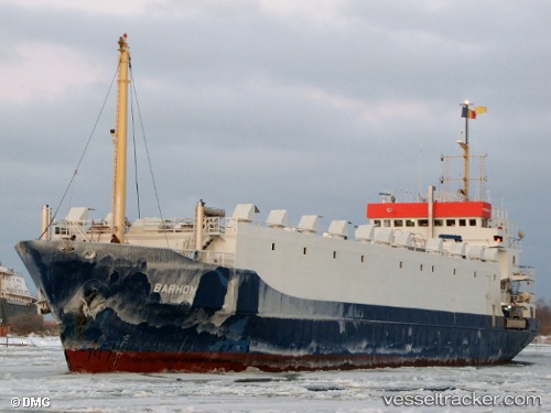
Vessel Barhom IMO: 7614848, MMSI: 677016500 Livestock Carrier
UTC, 30.43333, 48.15333, course: -1, speed: 0
UTC, 30.43333, 48.15333, course: -1, speed: 0
2026-01-17 12:06:44 UTC, 30.43333, 48.15333, course: -1, speed: 0
Live AIS position:
UTC. Near Khorramshahr),
updated 2026-01-17 12:06:44 UTC.
Find the position of the vessel Barhom on the map. The latter are known coordinates and path.
marine traffic ship tracker show on live map
The current position of vessel Barhom is 30.43333 lat / 48.15333 lng. Updated: 2026-01-17 12:06:44 UTCCurrently sailing under the flag of Tanzania
Barhom built in 1978 year
Deadweight:
2537 tDetails:
Last coordinates of the vessel:
UTC, 30.43333, 48.15333, course: -1, speed: 0UTC, 30.43333, 48.15333, course: -1, speed: 0
UTC, 30.43333, 48.15333, course: -1, speed: 0
2026-01-17 12:06:44 UTC, 30.43333, 48.15333, course: -1, speed: 0