 vesseltracker.com
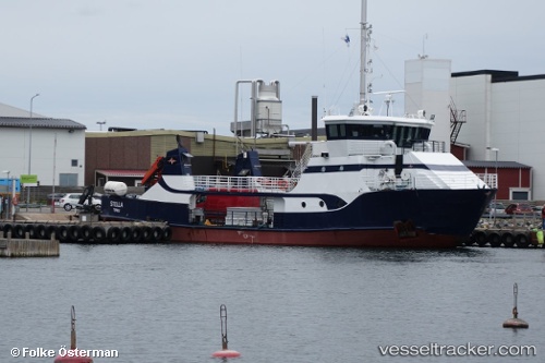
Vessel Stella IMO: 7724227, MMSI: 230051080 Passenger Ro Ro Cargo Ship
UTC, 59.92119, 22.41133, course: 171, speed: 0
UTC, 59.92116, 22.41136, course: 169, speed: 0
2026-01-15 07:34:40 UTC, 59.90449, 22.41988, course: 148, speed: 9.6
Live AIS position:
UTC. Near Kasnäs),
updated 2026-01-15 07:34:40 UTC.
Find the position of the vessel Stella on the map. The latter are known coordinates and path.
marine traffic ship tracker show on live map
The current position of vessel Stella is 59.90449 lat / 22.41988 lng. Updated: 2026-01-15 07:34:40 UTCCurrently sailing under the flag of Finland
Stella built in 1978 year
Deadweight:
10 tDetails:
Last coordinates of the vessel:
UTC, 59.92119, 22.41137, course: 171, speed: 0UTC, 59.92119, 22.41133, course: 171, speed: 0
UTC, 59.92116, 22.41136, course: 169, speed: 0
2026-01-15 07:34:40 UTC, 59.90449, 22.41988, course: 148, speed: 9.6