 vesseltracker.com
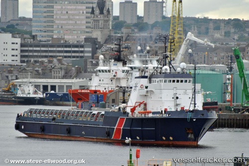
Vessel Mariner Sea IMO: 7727384, MMSI: 657982000 Offshore Tug Supply Ship
UTC, 4.75469, 7.04342, course: -1, speed: 0
UTC, 4.75469, 7.04342, course: -1, speed: 0
2026-01-17 18:30:41 UTC, 4.75468, 7.04331, course: -1, speed: 0
Live AIS position:
UTC. Near Port Harcourt),
updated 2026-01-17 18:30:41 UTC.
Find the position of the vessel Mariner Sea on the map. The latter are known coordinates and path.
marine traffic ship tracker show on live map
The current position of vessel Mariner Sea is 4.75468 lat / 7.04331 lng. Updated: 2026-01-17 18:30:41 UTCDetails:
Last coordinates of the vessel:
UTC, 4.75469, 7.04342, course: -1, speed: 0UTC, 4.75469, 7.04342, course: -1, speed: 0
UTC, 4.75469, 7.04342, course: -1, speed: 0
2026-01-17 18:30:41 UTC, 4.75468, 7.04331, course: -1, speed: 0