 vesseltracker.com
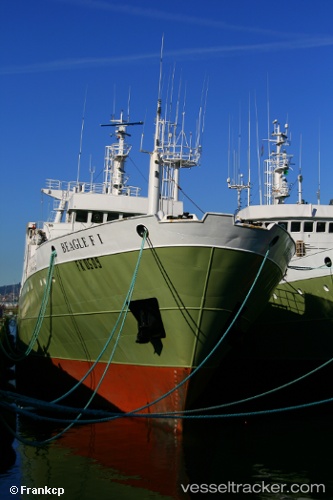
Vessel Beagle Fi IMO: 7813119, MMSI: 740337000 Fishing Vessel
UTC, 0.47576, -30.37298, course: 214, speed: 14.4
UTC, 0.27833, -30.52500, course: -1, speed: 14
2026-01-17 17:55:47 UTC, 0.19333, -30.58833, course: -1, speed: 14
Live AIS position:
UTC. 265 nm NE of Fernando De Noronha),
updated 2026-01-17 17:55:47 UTC.
Find the position of the vessel Beagle Fi on the map. The latter are known coordinates and path.
marine traffic ship tracker show on live map
The current position of vessel Beagle Fi is 0.19333 lat / -30.58833 lng. Updated: 2026-01-17 17:55:47 UTCDetails:
Last coordinates of the vessel:
UTC, 0.80167, -30.12667, course: -1, speed: 15UTC, 0.47576, -30.37298, course: 214, speed: 14.4
UTC, 0.27833, -30.52500, course: -1, speed: 14
2026-01-17 17:55:47 UTC, 0.19333, -30.58833, course: -1, speed: 14