 vesseltracker.com
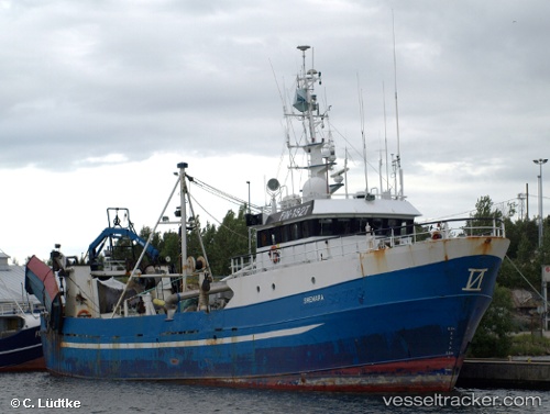
Vessel Shemara IMO: 7904750, MMSI: 230001770 Fishing Vessel
UTC, 59.46193, 22.82681, course: 9, speed: 2.5
UTC, 59.33438, 22.85752, course: 169, speed: 8.4
2026-01-16 07:52:06 UTC, 59.11206, 23.01036, course: 158, speed: 7.2
Live AIS position:
UTC. Near Salinõmme Paadisadam),
updated 2026-01-16 07:52:06 UTC.
Find the position of the vessel Shemara on the map. The latter are known coordinates and path.
marine traffic ship tracker show on live map
The current position of vessel Shemara is 59.11206 lat / 23.01036 lng. Updated: 2026-01-16 07:52:06 UTCCurrently sailing under the flag of Finland
Shemara built in 1980 year
Details:
Last coordinates of the vessel:
UTC, 59.40205, 22.73741, course: 355, speed: 2.4UTC, 59.46193, 22.82681, course: 9, speed: 2.5
UTC, 59.33438, 22.85752, course: 169, speed: 8.4
2026-01-16 07:52:06 UTC, 59.11206, 23.01036, course: 158, speed: 7.2