 vesseltracker.com
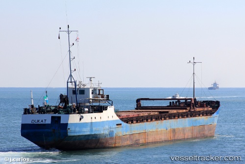
Vessel Dukat IMO: 7927714, MMSI: 667006102 Multi Purpose Carrier
UTC, 43.27437, 131.41933, course: -1, speed: 8.8
UTC, 43.27437, 131.41933, course: -1, speed: 8.8
2026-01-17 07:06:52 UTC, 43.27437, 131.41933, course: -1, speed: 8.8
Live AIS position:
UTC. 22 nm N of Slavyanka ),
updated 2026-01-17 07:06:52 UTC.
Find the position of the vessel Dukat on the map. The latter are known coordinates and path.
marine traffic ship tracker show on live map
The current position of vessel Dukat is 43.27437 lat / 131.41933 lng. Updated: 2026-01-17 07:06:52 UTCDetails:
Last coordinates of the vessel:
UTC, 43.27437, 131.41933, course: -1, speed: 8.8UTC, 43.27437, 131.41933, course: -1, speed: 8.8
UTC, 43.27437, 131.41933, course: -1, speed: 8.8
2026-01-17 07:06:52 UTC, 43.27437, 131.41933, course: -1, speed: 8.8