 vesseltracker.com
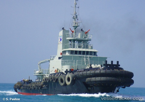
Vessel Al Wahsh IMO: 8017190, MMSI: 470135000 Tug
UTC, 26.29517, 50.80326, course: 214, speed: 1.4
UTC, 26.27133, 50.79346, course: 209, speed: 1.4
2026-01-17 06:25:42 UTC, 26.22612, 50.78455, course: 115, speed: 1.8
Live AIS position:
UTC. Near KHALIFA BIN SALMAN),
updated 2026-01-17 06:25:42 UTC.
Find the position of the vessel Al Wahsh on the map. The latter are known coordinates and path.
marine traffic ship tracker show on live map
The current position of vessel Al Wahsh is 26.22612 lat / 50.78455 lng. Updated: 2026-01-17 06:25:42 UTCDetails:
Last coordinates of the vessel:
UTC, 26.31830, 50.80873, course: 193, speed: 2.3UTC, 26.29517, 50.80326, course: 214, speed: 1.4
UTC, 26.27133, 50.79346, course: 209, speed: 1.4
2026-01-17 06:25:42 UTC, 26.22612, 50.78455, course: 115, speed: 1.8