 vesseltracker.com
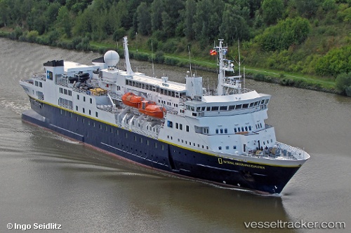
Vessel N G Explorer IMO: 8019356, MMSI: 309336000 Cruise Ship
UTC, -62.81381, -60.40122, course: 95, speed: 10.7
UTC, -62.76159, -60.14486, course: 59, speed: 10
2026-01-16 01:26:26 UTC, -62.59500, -59.55667, course: -1, speed: 11
Live AIS position:
UTC. Near Arturo Prat),
updated 2026-01-16 01:26:26 UTC.
Find the position of the vessel N G Explorer on the map. The latter are known coordinates and path.
marine traffic ship tracker show on live map
The current position of vessel N G Explorer is -62.59500 lat / -59.55667 lng. Updated: 2026-01-16 01:26:26 UTCCurrently sailing under the flag of Bahamas
N G Explorer built in 1982 year
Deadweight:
1301 tDetails:
Last coordinates of the vessel:
UTC, -62.79667, -60.72500, course: -1, speed: 10UTC, -62.81381, -60.40122, course: 95, speed: 10.7
UTC, -62.76159, -60.14486, course: 59, speed: 10
2026-01-16 01:26:26 UTC, -62.59500, -59.55667, course: -1, speed: 11