 vesseltracker.com
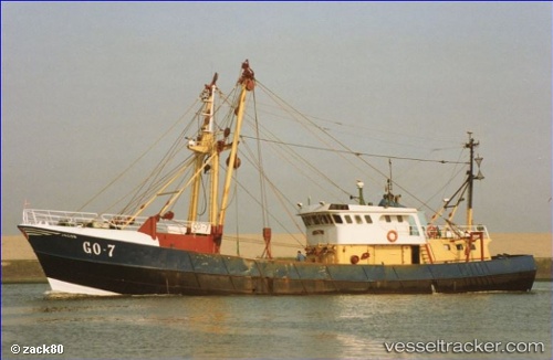
Vessel Mary J IMO: 8022664, MMSI: 250392000 Fishing Vessel
UTC, 51.18333, -7.29500, course: -1, speed: 1
UTC, 51.18333, -7.29500, course: -1, speed: 1
2026-01-16 05:36:45 UTC, 51.19667, -7.26833, course: -1, speed: 2
Live AIS position:
UTC. 33 nm SE of Covent Garden),
updated 2026-01-16 05:36:45 UTC.
Find the position of the vessel Mary J on the map. The latter are known coordinates and path.
marine traffic ship tracker show on live map
The current position of vessel Mary J is 51.19667 lat / -7.26833 lng. Updated: 2026-01-16 05:36:45 UTCCurrently sailing under the flag of Ireland
Details:
Last coordinates of the vessel:
UTC, 51.26833, -7.38333, course: -1, speed: 4UTC, 51.18333, -7.29500, course: -1, speed: 1
UTC, 51.18333, -7.29500, course: -1, speed: 1
2026-01-16 05:36:45 UTC, 51.19667, -7.26833, course: -1, speed: 2