 vesseltracker.com
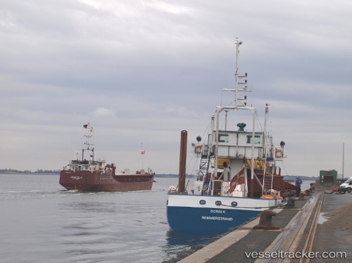
Vessel Doris K IMO: 8203531, MMSI: 219011491 Hopper Dredger
UTC, 55.45770, 12.22273, course: 95, speed: 7.7
UTC, 55.43651, 12.39370, course: 149, speed: 1
2026-01-15 10:43:27 UTC, 55.44231, 12.38774, course: 331, speed: 0.9
Live AIS position:
UTC. Near Strøby),
updated 2026-01-15 10:43:27 UTC.
Find the position of the vessel Doris K on the map. The latter are known coordinates and path.
marine traffic ship tracker show on live map
The current position of vessel Doris K is 55.44231 lat / 12.38774 lng. Updated: 2026-01-15 10:43:27 UTCCurrently sailing under the flag of Denmark
Doris K built in 1982 year
Deadweight:
1089 tDetails:
Last coordinates of the vessel:
UTC, 55.45772, 12.20416, course: 89, speed: 3.1UTC, 55.45770, 12.22273, course: 95, speed: 7.7
UTC, 55.43651, 12.39370, course: 149, speed: 1
2026-01-15 10:43:27 UTC, 55.44231, 12.38774, course: 331, speed: 0.9