 vesseltracker.com
Live AIS position:
50.81500° N, 128.26666° W UTC. 29 nm NW of Coal Harbour),
updated 2025-11-20 06:38:35 UTC.
Find the position of the vessel SIR WILFRID LAURIER on the map. The latter are known coordinates and path.
marine traffic ship tracker show on live map
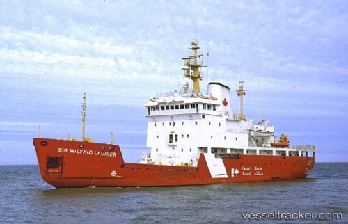
The current position of vessel SIR WILFRID LAURIER is 50.81500 lat / -128.26666 lng. Updated: 2025-11-20 06:38:35 UTCCurrently sailing under the flag of Canada
SIR WILFRID LAURIER built in 1986 year
Deadweight:
1585 tDetails:
Last coordinates of the vessel:
UTC, 50.81548, -128.26558, course: 190, speed: 0.3UTC, 50.81500, -128.26500, course: -1, speed: 0
UTC, 50.81500, -128.26666, course: -1, speed: 0
2025-11-20 06:38:35 UTC, 50.81500, -128.26666, course: -1, speed: 0