 vesseltracker.com
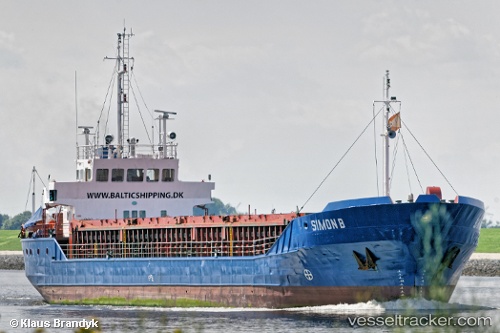
Vessel Simon B IMO: 8511029, MMSI: 218801000 Multi Purpose Carrier
UTC, 53.6129, 9.55594, course: 134, speed: 0
UTC, 53.613, 9.55565, course: 137, speed: 0
2026-01-15 03:33:04 UTC, 53.613, 9.55546, course: 119, speed: 0.2
Live AIS position:
UTC. Near Stadersand),
updated 2026-01-15 03:33:04 UTC.
Find the position of the vessel Simon B on the map. The latter are known coordinates and path.
marine traffic ship tracker show on live map
The current position of vessel Simon B is 53.613 lat / 9.55546 lng. Updated: 2026-01-15 03:33:04 UTCCurrently sailing under the flag of Germany
Simon B built in 1986 year
Deadweight:
2380 tDetails:
Last coordinates of the vessel:
UTC, 53.6123, 9.55778, course: 253, speed: 0.2UTC, 53.6129, 9.55594, course: 134, speed: 0
UTC, 53.613, 9.55565, course: 137, speed: 0
2026-01-15 03:33:04 UTC, 53.613, 9.55546, course: 119, speed: 0.2