 vesseltracker.com
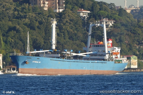
Vessel Aysha M IMO: 8511146, MMSI: 620050000 General Cargo Ship
UTC, 45.33466, 28.79371, course: 258, speed: 0
UTC, 45.33464, 28.79371, course: 266, speed: 0.1
2026-01-17 19:15:25 UTC, 45.33457, 28.79364, course: 270, speed: 0
Live AIS position:
UTC. Near TULCEA),
updated 2026-01-17 19:15:25 UTC.
Find the position of the vessel Aysha M on the map. The latter are known coordinates and path.
marine traffic ship tracker show on live map
The current position of vessel Aysha M is 45.33457 lat / 28.79364 lng. Updated: 2026-01-17 19:15:25 UTCCurrently sailing under the flag of Comoros
Aysha M built in 1985 year
Deadweight:
5628 tDetails:
Last coordinates of the vessel:
UTC, 45.33471, 28.79369, course: 256, speed: 0UTC, 45.33466, 28.79371, course: 258, speed: 0
UTC, 45.33464, 28.79371, course: 266, speed: 0.1
2026-01-17 19:15:25 UTC, 45.33457, 28.79364, course: 270, speed: 0