 vesseltracker.com
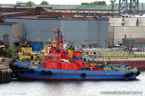
Vessel Siroko IMO: 8523307, MMSI: 273442990 Tug
UTC, 45.29741, 36.45749, course: -1, speed: 52.4
UTC, 45.11541, 37.01553, course: -1, speed: 7.8
2026-01-15 05:17:33 UTC, 45.06200, 36.60070, course: -1, speed: 7.8
Live AIS position:
UTC. 11 nm SW of Taman'),
updated 2026-01-15 05:17:33 UTC.
Find the position of the vessel Siroko on the map. The latter are known coordinates and path.
marine traffic ship tracker show on live map
The current position of vessel Siroko is 45.06200 lat / 36.60070 lng. Updated: 2026-01-15 05:17:33 UTCDetails:
Last coordinates of the vessel:
UTC, 45.30782, 36.45418, course: -1, speed: 8.3UTC, 45.29741, 36.45749, course: -1, speed: 52.4
UTC, 45.11541, 37.01553, course: -1, speed: 7.8
2026-01-15 05:17:33 UTC, 45.06200, 36.60070, course: -1, speed: 7.8