 vesseltracker.com
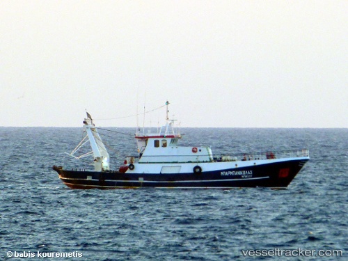
Vessel Barbanikolas IMO: 8690564, MMSI: 240430000 Fishing Vessel
UTC, 37.71111, 24.05730, course: -1, speed: 0
UTC, 37.71111, 24.05730, course: -1, speed: 0
2026-01-13 18:27:33 UTC, 37.71111, 24.05730, course: -1, speed: 0
Live AIS position:
UTC. Near LAVRIO),
updated 2026-01-13 18:27:33 UTC.
Find the position of the vessel Barbanikolas on the map. The latter are known coordinates and path.
marine traffic ship tracker show on live map
The current position of vessel Barbanikolas is 37.71111 lat / 24.05730 lng. Updated: 2026-01-13 18:27:33 UTCCurrently sailing under the flag of Greece
Details:
Last coordinates of the vessel:
UTC, 37.71111, 24.05730, course: -1, speed: 0UTC, 37.71111, 24.05730, course: -1, speed: 0
UTC, 37.71111, 24.05730, course: -1, speed: 0
2026-01-13 18:27:33 UTC, 37.71111, 24.05730, course: -1, speed: 0